File:ArgothMap.png
Jump to navigation
Jump to search
Size of this preview: 790 × 600 pixels. Other resolution: 2,009 × 1,525 pixels.
Original file (2,009 × 1,525 pixels, file size: 2.45 MB, MIME type: image/png)
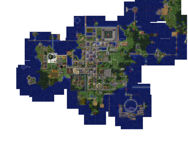
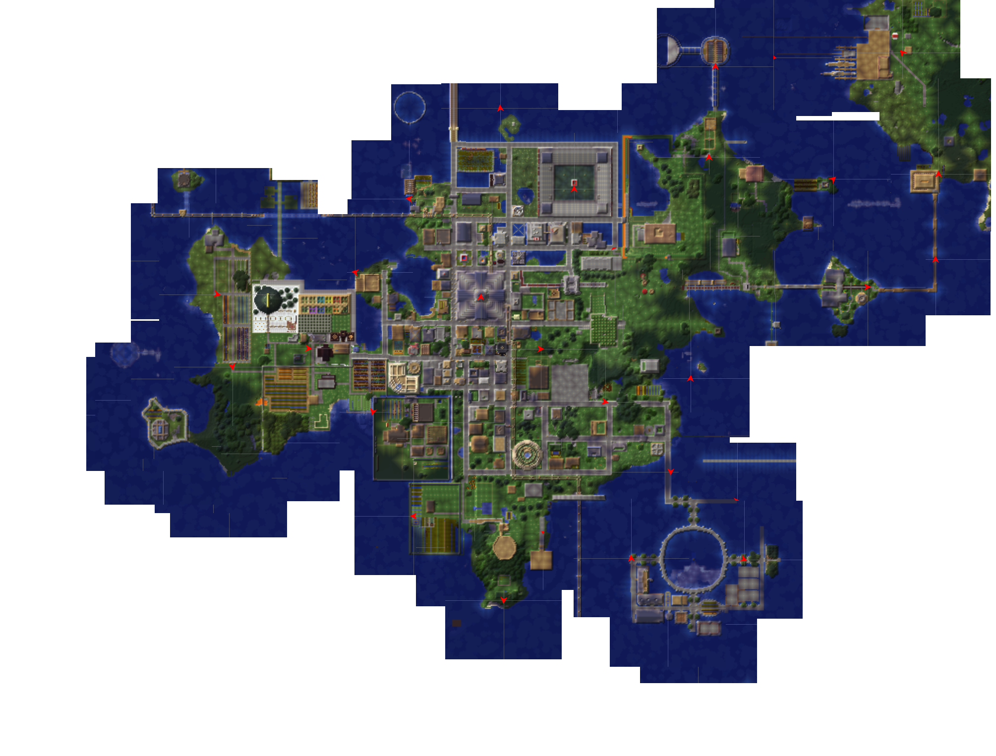
Map of the Island including the Naval base as of February 15,2012
File history
Click on a date/time to view the file as it appeared at that time.
| Date/Time | Thumbnail | Dimensions | User | Comment | |
|---|---|---|---|---|---|
| current | 17:45, 20 February 2012 | | 2,009 × 1,525 (2.45 MB) | SilentStrike (talk | contribs) | Map of the Island including the Naval base as of February 15,2012 |
You cannot overwrite this file.
File usage
The following page uses this file: